Travel and Hiking

Awaiting moderation
Multiple dates 8:00 am - 18:00 pm Toggle calendar
Event QR Code
2069/person

We are happy to offer this incredible trip again. It is the fourth time we've organized the trip. Not only we improve entertaiment items such as sand skiing, ride a camel, enjoy flying a Kongming lantern and campfire party in the endless desert, also we have a storng logistical support to keep everyone can finish the trip. You have enough water, food supply. Don't hesitate to join the trip with us. Smile


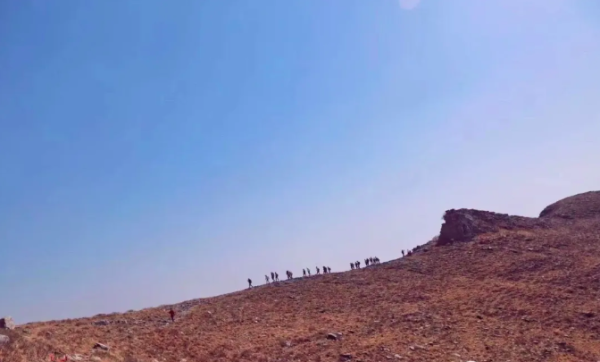
Tengger Desert, also called Tenggeli Desert in Chinese, is located in southwestern Alxa Left Banner, Inner Mongolia Autonomous Region. It borders the Gansu Province and Ningxia Hui Autonomous Region. Tengger Desert is 240 kilometers (149 miles) from north to south, and 160 kilometers (99 miles) from east to west, making it the fourth largest desert in China with a size of 43,000 square kilometers (16,602 sq miles). Sand dunes cover 71 percent of this area, accompanied by several inner lakes, flatlands, grasslands and hills. At first glance, this large-scale desert seems to extend to reach the blue sky.


Swan Lake Viewing


Swan Lake is the most famous one among all the inner lakes of the Tengger Desert. Along the lake shore are many sand jujube trees. The best time to visit Swan Lake is March to May. Many swans roost and play here in late March and early April; at the same time visitors can enjoy flourishing Malan flowers.


Moon Lake Sightseeing


Another attractive scenic area is Moon Lake, around 35 kilometers (22 miles) from Swan Lake. It is a favorable desert adventure camp site. Surprisingly, half of the lake is fresh water, and another part is salty water. The shape of Moon Lake is similar to that of a map of China.


Lighting a Kongming lantern to make a small wish, let it fly in the vast desert.


Itinerary:


For this trip, we are traveling by train. Here is train information:


Train recommendation:


Date: April 3rd


Train number: Z277


Destination: Yinchuan


Departure time: 20:06pm


Arrival time: 06:56am (second day)


Day 1: April 4th - Hiking Distance: 15km


Schedule:


08.00: Set out from Yinchuan train station and towards to the Tengger Desert by vehicle. We will meet at train station in the morning. (The specific location we will post in the group before arriving there.)


11:00: Arrive the Tengger Desert, beginning of hike


12:00: Have a lunch break


19:00: Arrive the Swan Lake and end of hike


Accommodation: Camping (There is a public showering place, if you'd like to take shower, you need to pay by youself. )


Group dinner: Chicken stew with rice


Note: You can put your luggage on the vehicle and take drinks and food you need when you are hiking. You need to prepare your first day lunch by yourself.


Day 2: April 5th - Hiking Distance: 27km


Schedule:


07:00: Breakfast;everyone will get your lunch from the organizer including main food, fruit and water.


08:00: Starting the hike


11:30: Arrive at Wulan lake to have a lunch break


17:00: Arrive the terminal


Accommodation: Camping (There is a public showering place, if you'd like to take shower, you need to pay by youself. )


Group dinner: Lamb stew with rice


Note: We hike 27 kilometers all day in the heart of the desert. You can put your luggage on the vehicle and take drinks and food you need when you are hiking. When we are hiking towards the heart of dessert, lakes show in front of your eyes, what a wonderful nature is.


Day 3: April 6th - Hiking Distance: 18km


Schedule:


06:00: Breakfast; everyone will get lunch from the organizer including food, fruit and water. (The distance will be shorten; It depents on hikers status.)


07:00: Starting the hike


12:00: Lunch break at Jigetu lake


14:00: Ending the hike


16:00: Arrive back Yinchuan


Note: After the hike, we rent a vehicle back to Yinchuan around 4.00pm. If you book a flight, you could choose a flight after 6.00pm.


3-Day trip information:


Date: April 4th - April 6th


Leaders: Lengzhi and Nuanyang


Price: 2069/person (6 people)


Price: 1969/person (7 people)


Price: 1869/person (8 people)


Includes:


Transportation during the trip in the hiking


Activities - sand surfuing, camel riding in 1km, flying Kongming lantern


Attractions tickets, and meals as listed in the itinerary


Accommodations listed in the itinerary


24/7 helpline while you are traveling


3 days Insurance


A small gift bag (for HikersFamily members)


Excludes


Transportation to and from Yinchuan


Personal expenses


Pay full payment when we confirm the trip. We will confirm the trip on Mach 17th.


The cancellation fee will be calculated as follows:


Cancellation received after Mach 17th: 0% refund


Join us:


Add mona_zhangli as your wechat, or scan the QR in below. I'll add you into the group.

Images

Awaiting moderation
Multiple dates 7:00 am - 16:00 pm Toggle calendar
Event QR Code
2069/person

We are happy to offer this incredible trip again. It is the fourth time we've organized the trip. Not only we improve entertaiment items such as sand skiing, ride a camel, enjoy flying a Kongming lantern and campfire party in the endless desert, also we have a storng logistical support to keep everyone can finish the trip. You have enough water, food supply. Don't hesitate to join the trip with us. Smile


Tengger Desert, also called Tenggeli Desert in Chinese, is located in southwestern Alxa Left Banner, Inner Mongolia Autonomous Region. It borders the Gansu Province and Ningxia Hui Autonomous Region. Tengger Desert is 240 kilometers (149 miles) from north to south, and 160 kilometers (99 miles) from east to west, making it the fourth largest desert in China with a size of 43,000 square kilometers (16,602 sq miles). Sand dunes cover 71 percent of this area, accompanied by several inner lakes, flatlands, grasslands and hills. At first glance, this large-scale desert seems to extend to reach the blue sky.


Swan Lake Viewing


Swan Lake is the most famous one among all the inner lakes of the Tengger Desert. Along the lake shore are many sand jujube trees. The best time to visit Swan Lake is March to May. Many swans roost and play here in late March and early April; at the same time visitors can enjoy flourishing Malan flowers.


Moon Lake Sightseeing


Another attractive scenic area is Moon Lake, around 35 kilometers (22 miles) from Swan Lake. It is a favorable desert adventure camp site. Surprisingly, half of the lake is fresh water, and another part is salty water. The shape of Moon Lake is similar to that of a map of China.


Lighting a Kongming lantern to make a small wish, let it fly in the vast desert.


Itinerary:


For this trip, we are traveling by train. Here is train information:


Train recommendation:


Date: April 3rd


Train number: Z277


Destination: Yinchuan


Departure time: 20:06pm


Arrival time: 06:56am (second day)


Day 1: April 4th - Hiking Distance: 15km


Schedule:


08.00: Set out from Yinchuan train station and towards to the Tengger Desert by vehicle. We will meet at train station in the morning. (The specific location we will post in the group before arriving there.)


11:00: Arrive the Tengger Desert, beginning of hike


12:00: Have a lunch break


19:00: Arrive the Swan Lake and end of hike


Accommodation: Camping (There is a public showering place, if you'd like to take shower, you need to pay by youself. )


Group dinner: Chicken stew with rice


Note: You can put your luggage on the vehicle and take drinks and food you need when you are hiking. You need to prepare your first day lunch by yourself.


Day 2: April 5th - Hiking Distance: 27km


Schedule:


07:00: Breakfast;everyone will get your lunch from the organizer including main food, fruit and water.


08:00: Starting the hike


11:30: Arrive at Wulan lake to have a lunch break


17:00: Arrive the terminal


Accommodation: Camping (There is a public showering place, if you'd like to take shower, you need to pay by youself. )


Group dinner: Lamb stew with rice


Note: We hike 27 kilometers all day in the heart of the desert. You can put your luggage on the vehicle and take drinks and food you need when you are hiking. When we are hiking towards the heart of dessert, lakes show in front of your eyes, what a wonderful nature is.


Day 3: April 6th - Hiking Distance: 18km


Schedule:


06:00: Breakfast; everyone will get lunch from the organizer including food, fruit and water. (The distance will be shorten; It depents on hikers status.)


07:00: Starting the hike


12:00: Lunch break at Jigetu lake


14:00: Ending the hike


16:00: Arrive back Yinchuan


Note: After the hike, we rent a vehicle back to Yinchuan around 4.00pm. If you book a flight, you could choose a flight after 6.00pm.


3-Day trip information:


Date: April 4th - April 6th


Leaders: Lengzhi and Nuanyang


Price: 2069/person (6 people)


Price: 1969/person (7 people)


Price: 1869/person (8 people)


Includes:


Transportation during the trip in the hiking


Activities - sand surfuing, camel riding in 1km, flying Kongming lantern


Attractions tickets, and meals as listed in the itinerary


Accommodations listed in the itinerary


24/7 helpline while you are traveling


3 days Insurance


A small gift bag (for HikersFamily members)


Excludes


Transportation to and from Yinchuan


Personal expenses


Pay full payment when we confirm the trip. We will confirm the trip on Mach 17th.


The cancellation fee will be calculated as follows:


Cancellation received after Mach 17th: 0% refund


Join us:


Add mona_zhangli as your wechat, or scan the QR in below. I'll add you into the group.

Images

Awaiting moderation
Multiple dates 7:00 am - 16:00 pm Toggle calendar
Event QR Code
690/person

Taihang Mountain is divided into three sections, namely the North Taihang, the South Taihang and the West Taihang. Hebei province is the North Taihang; Henan province is called the South Taihang, and the West Taihang is in Shanxi Province. The most beautiful part of Taihang mountain is in the South. So we choose the classic sections and got lots of good feedbacks. This time, let's enjoy the flowers blooming.


Itinerary:


Day 1: Mawuzhai- Yixiantian- Qixingtan- Baoducun(village)


Mawuzhai is located in Mawu Mountain;it is an important transfer station. Then we will enter the Baodu Canyon which the road is steep but beautiful. Yixiantian is the passing the road from Mawuzhai to Baodu village. Also Yixiantian is the most dangerous place in the whole Baodu Canyon. There are three cliffs and three times descend of 10 meters. The slope is nearly 80 degrees. Now though the route is protected by a fixed chain, you still could feel chilling.


Hike information:


Distance: 12km


Ascent: 500-600m


Time to complete: 7 hours


Lunch: lunchh to be prepared by yourself


Group dinner


Accommodation: local family


Day 2: Baodu village- Laolongkou- Baligou tourist place


Baotu Grand Canyon can be compared with Antelope Valley. There are patches of red quartzite where the Taihang Mountain suddenly breaks down in nearly 300 meters. We will pass by Dongjiazhai and go down from Tianti towards to Baligou Canyon. Baligou is also the main scenic spot of South Taihang mountain. The length is 4km and has waterfalls, especially the water curtain cave is designed uniquely.


We come out from the main gate of the scenic spot and return to Xinxiang. Also we will stop at Xinxiang East Station and Xinxiang station respectively. You can choose the train after 18:00 from Xinxiang East station to Beijing West Station.


See you next time!


Hike information:


Distance: 14-15km


Ascent: 500-600m


Time to complete: 7 hours


Ending time: 16:30


Group breakfast


Lunch: lunch to be prepared by yourself.


Trip information:


Date: March 29th (Friday night) - 31st


Number of people: 6-8


Train number K179 22:17 from Beijing west station to Xinxiang. The arrival time is 05:26am. It is a night sleeping train. (Then we will pick you up at 07:00 am at the train staion.)


Drive time: 2 hours from train staion to the hiking point (Mawuzhai village)


Drive distance: 105km


The event fee: 690/person


Price includes:


1. Transportation with a driver


2. Our Hiking Leader


3. Two days outdoor insurance


4. Accommodations (the living condition is not good, also it is worse than staying in the Beijing suburb.)


5. Meals listed in the itinerary


Join us:


Add mona_zhangli as your wechat, or scan the QR in below. I'll add you intoHikersFamily group.

Images

Awaiting moderation
Mar 2 7:30 am - 16:00 pm
Event QR Code
150/person

Mangshan, the highest peak is at 659 meters. According to the Ming Dynasty's selection of the Ming Tombs site, it was chosen by ancient people based on Feng Shui principles: left is the Azure Dragon, and right is the White Tiger. The left dragon refers to Mangshan, with its picturesque landscape and water, resembling an embracing posture, was chosen by Chongzhen emperor as the location for his tomb.


Although it is not extremely high, still requires a bit physical effort to climb up. There are multiple hiking trails to reach the summit where you can enjoy the view of the Ming Tombs if the air quality is high. Also you can see the reservoir of the Ming Tombs. The scenery is exceptionally beautiful. Meanwhile there is the largest artificial pool on the top. It is said that the gate can be opened to generate electricity in emergency. This is a spectacular experience.


Hike Information:


l Date: March 2nd (Saturday)


l Location: Changping


l Drive time: 1.2 hours each way


【The route type】Climbing up is the mountain route; Climbing down is friendly repaired steps.


【The route description】The mountain slopes are mostly on the sunny side and semi-sunny side with gradients around 30 degrees, relatively gentle in the slope. When we go down from the tourist place and the public road is steps. (Reference level 1.2)


l Distance: 8km


l Time to complete: 4-5hours


l Total ascent: 618m


l Total descent: 558m


l Peak: 641m


l Lowest point: 78m


Note:


1. Take at least 2 bottles of water.


2. Bring some lunch, and some snacks.


3. Hiking boots is recommended.


4. More details will be posted in the group before hiking.


Itinerary:


07.30: Departure from Dongzhimen (line2 exit B)


08.45: Arrive the village, beginning of hike


16.00: Arrive back in Beijing


Activity Fee: 150RMB/person


Price includes:


1. Transportation (a vehicle with a driver)


2. Hiking Leaders: Lengzhi, Nuanyang


3. One day outdoor insurance.


4. Payment: After hiking, you can transfer to Mona.


Please note:


- Do not participate if you are sick or showing symptoms of ever or couching.


- Customer service: Mona (wechat id: mona_zhangli) If you have any suggestions orcomplaint, please feel free to leave messages.


- Photos will be used in the social media platform. If you don't want to show in the picture, let us know. Smile


Cancellation:


1. You can cancel anytime till the deadline on Friday 18:00PM. As we have to fix capacties for the bus and the guides. After deadline, we will have charge you 80% activity fee. Or you find another person not yet registered to join the hike. If your cancellation is on Saturday morning, please pay 100% activity fee. We repect your choice. When you register for this activity, you accept this cancelation policy.


2. Bad weather plan:We will message you 1-2 days before the hike to let you know about theweather condition. If there is a thunderstorm, heavy rain or strongwinds it will be dangerous to do the hike in the high mountains. Sowe will cancel it or change the dates.


Join us:


Add mona_zhangli as your wechat, or scan the QR in below. I'll add you into HikersFamily group.


(Also, our Tengger Desert trekking is coming soon.)

Images

Awaiting moderation
Jan 27 7:30 am - 17:00 pm
Event QR Code
150/person

Before starting to thaw completely, let's do Baihe walking again.


Baihe is a canyon landscape and has been described as a "Hundred Miles Gallery". Baihe canyon keeps the natural features and there are relatively few villages. Therefore, it is suitable for natural exploration. You can enjoy the canyon from the northeast of the Baihebao Reservoir in Yanqing County. Nearly 100 meters high cliffs like sharp swords splits Baihe. The towering Ming Dynasty Great Wall winds in the mountains. Cliffs on both sides of the river, the nature scenery is quite fantastic. Great for summer and winter.


In summer, we hiked here and followed the paths beside the river or chose to cross several times on the way down. In the winter, the river freezes over, we can walk on the ice or follow side trails if necessary.


Hike Information:


l Date: Jan. 27th (Saturday)


l Location: Miyun section


l Drive time: 2 hours each way


【The route type】walking along with the rive side


【The route description】No climbing; walking and enjoy the view (Reference level 0.8; level 1 give some buffer in the winter time~;))


l Distance: 8km


l Time to complete: 4-5hours


l Total ascent: 53m


l Total descent: 43m


l Peak: 243m


l Lowest point: 197m


Notes:


1. Take at least 2 bottles of water.


2. Bring some lunch, and some snacks.


3. Wear comfortable sport shoes (keep your feet warm).


4. More details will be posted in the group before hiking.


Itinerary:


07.30: Departure from Dongzhimen (line2 exit B)


09.30: Arrive the village, beginning of hike


17.00: Arrive back in Beijing


Activity Fee: 150RMB/person


Price includes:


1. Transportation (a vehicle with a driver)


2. Hiking Leaders: Lengzhi, Nuanyang


3. One day outdoor insurance.


4. Payment: After hiking, you can transfer to Mona.


Excluded entrance fee: 20RMB/person (The price is in 2023 winter time.)


Please note:


- Do not participate if you are sick or showing symptoms of ever or couching.


- Customer service: Mona (wechat id: mona_zhangli) If you have any suggestions orcomplaint, please feel free to leave messages.


- Photos will be used in the social media platform. If you don't want to show in the picture, let us know. Smile


Cancellation:


1. You can cancel anytime till the deadline on Friday 18:00PM. As we have to fix capacties for the bus and the guides. After deadline, we will have charge you 80% activity fee. Or you find another person not yet registered to join the hike. If your cancellation is on Saturday morning, please pay 100% activity fee. We repect your choice. When you register for this activity, you accept this cancelation policy.


2. Bad weather plan:We will message you 1-2 days before the hike to let you know about theweather condition. If there is a thunderstorm, heavy rain or strongwinds it will be dangerous to do the hike in the high mountains. Sowe will cancel it or change the dates.


Join us:


Add mona_zhangli as your wechat, or scan the QR in below. I'll add you into HikersFamily group.


Images

Awaiting moderation
Multiple dates 9:00 am - 19:00 pm Toggle calendar
Event QR Code
Wanning, Hainan
¥10980 per student

Enjoy a complete change of scene this winter or spring holiday in the tropical paradise of Hainan Island.


What better place to learn the exciting sport of surfing, playing stand-up paddleboarding (SUP) in the rainfores, and experiencing the entire process of how a cocoa tree transforms into delicious chocolate! And who better to learn with than your favourite instructors from Imagine!


Images

Family Friendly Event
Awaiting moderation
Mar 31 8:00 am -
Event QR Code
At which venue:
¥450 / ¥405 for members

Follow a trail through the Changping countryside, passing villages, quarries, and a local shrine on the way to the Silver Pagodas, a set of five well-preserved 600-year-old pagodas that are all that remains of a big Buddhist temple.


We start off with a walk through a small village, stopping for a quick look at a 300-year-old performance stage and a temple.


After walking through the village we’ll follow a slowly ascending path through the countryside, passing an isolated shrine, fields, and concrete water reservoirs as we circle Silver Mountain.


Around the hill behind the village we’ll find what’s called the “Valley of Mercy”, and this is where the path starts to get a lot steeper, heading past more quarries and following a hillside trail up to the top of Holly Mountain. The valley is not too merciful to the legs. It’s quite a good climb!


Towards the top we’ll find the Silver Pagoda park trail, and climb its steps to the viewing platform at the top. We can look down on the pagodas from there, and will have an unobstructed 360° view of the surrounding mountain peaks and countryside.


From the top we’ll follow the park trail down to the pagodas, passing the Bell Pavilion, the Waist-Turning Pagoda, the Preaching Platform, and other spots used by the monks and nuns when the temple was still active.


Includes a post-hike lunch at a countryside restaurant.


Cost: ¥450 / ¥405 for members


See a full description, more photos, and book online at https://www.beijinghikers.com/hike-in-beijing/view/389/silver-pagoda-loop-2/


Beijing Hikers—fun and friendly hikes and trips around Beijing and greater China, since 2001.


For more updates on hikes and trips follow our WeChat account BeijingHikers北京爱山 and keep an eye on www.beijinghikers.com


https://www.beijinghikers.com / info@beijinghikers.com

Images

Awaiting moderation
Mar 30 8:00 am -
Event QR Code
At which venue:
¥390 / ¥350 for members

Ramble about in the hills of Huailai, passing villages, valleys, and fields, with views of big mountains and Great Wall.


The ‘Camp’ part of the name comes from the village being an old supply point for the wall in this area, back in the Ming Dynasty. Nowadays the village is virtually empty, apart from when everyone shows up for the planting and harvest seasons.


From the village we continue along a dirt road, aiming for the meadows by the Great Wall. We’ll hike up to the wall for a look. The wall here is built on a cliff, and the views are amazing.


We’ll follow the wall and then head down into a valley to find another interesting feature of the Great Wall in this area – a gate in the wall at the end of the valley.


This gate is called the Water Pass, and perhaps it was made to allow water from the gully to flow through. More likely it was an actual gate, as there are signs of it having had a door. With the wall beyond the gate all tumbled down it’s tough to tell if there were steps to climb up to the gate, or if a ladder would have been used.


This line of wall is fairly steep, and a lot of it has fallen down. This makes it a fairly tricky climb. But it’s worth it, with the views getting better and better the higher we get.


We’ll climb up over the gate and follow a narrow trail that takes us up on to the wall high above, which we’ll then follow up to a high point.


This line of wall is fairly steep, and a lot of it has fallen down. This makes it a fairly tricky climb. But it’s worth it, with the views getting better and better the higher we get.


We’ll aim to get to the high point for lunch, and we’ll stop to enjoy the views as we eat – Great Wall on two sides, and mountains and valleys all around.


Bring your passport/ID in case we get checked at the border crossing on the way home.


Cost: ¥390 / ¥350 for members


See a full description, more photos, and book online at https://www.beijinghikers.com/hike-in-beijing/view/746/big-camp-plate-village-and-hengling-valley/


Beijing Hikers—fun and friendly hikes and trips around Beijing and greater China, since 2001.


For more updates on hikes and trips follow our WeChat account BeijingHikers北京爱山 and keep an eye on www.beijinghikers.com


https://www.beijinghikers.com / info@beijinghikers.com

Images

Awaiting moderation
Mar 30 10:00 am -
Event QR Code
At which venue:
¥1,720 / ¥1,550 for members / ¥1,300 for kids

On this two day Great Wall adventure you’ll hike picturesque stretches of the wild Great Wall and camp in a Great Wall tower at Gubeikou.


We'll supply a tent, sleeping bag, and ground pad for you, as well as food for a basic dinner and breakfast. All you’ll need is a day pack to carry your essentials while hiking, leaving you free to enjoy the scenery, sunset, stars, and sunrise as we hike along the Gubeikou and Jinshanling sections of the Great Wall.


On the first day of the trip we’ll explore the Great Wall at Gubeikou, a relatively easy hike that has magnificent views of the Great Wall running through the hills. We'll hike up to the highest tower in the area, and then walk back down to our campsite to cook dinner and watch the sun set.


On the second day of the trip we’ll hike on to the Jinshanling Great Wall. We'll hike back up to the high point of the Gubeikou Great Wall, and then head down into the farmland that surrounds Hemp Village. After a 45-60 minute hike through the fields, we'll climb a hill trail to get on to the western end of the Jinshanling Great Wall. We’ll walk all of the Jinshanling section of the Great Wall to finish at the eastern end with a walk down a park trail to the carpark where our bus will meet us.


Maximum group size of 10–12 hikers; book early to make sure you get a spot!


Bring your passport/ID in case we get checked at the border crossing on the way home.


Cost: ¥1,720 / ¥1,550 for members / ¥1,300 for kids


See a full description, more photos, and book online at https://www.beijinghikers.com/hike-in-beijing/view/654/camping-gubeikou-great-wall-and-jinshanling-great-wall-4/


Beijing Hikers—fun and friendly hikes and trips around Beijing and greater China, since 2001.


For more updates on hikes and trips follow our WeChat account BeijingHikers北京爱山 and keep an eye on www.beijinghikers.com


https://www.beijinghikers.com / info@beijinghikers.com

Images

Awaiting moderation
Mar 27 8:15 am -
Event QR Code
At which venue:
¥510 / ¥460 for members

Walk from Gubeikou to Jinshanling, following stretches of restored and unrestored Great Wall and taking a detour through the pretty farmland that surrounds Hemp Village, finishing all the way over at the eastern end of Jinshanling.


Walk from Gubeikou to Jinshanling, following stretches of restored and unrestored Great Wall and taking a detour through the pretty farmland that surrounds Hemp Village, finishing all the way over at the eastern end of Jinshanling.


The hike begins at the Gubeikou section of the Great Wall in Miyun County, very close to the border of the Beijing and Hebei provinces. Even though it’s designated as a park, this section of the Great Wall is largely unrestored. It’s not often visited either, probably because it is so far away from central Beijing.


We’ll start the walk with a short climb up to a tower on the Wall. There are a lot of towers on this stretch of the Wall – some in good condition, some tumbled down to foundations only. From the first tower we can see the Wall stretching off into the hills of northern Miyun. We’ll be following it the other way, towards Jinshanling, and Hebei Province.


Along the way to Jinshanling we’ll get a different view of the wall, walking a trail by the base of the Mongolia side, and making a few tricky ascents and descents on the way to the archway that will get us back on top. This section is the west side of the Jinshanling Great Wall.


We’ll be following the Jinshanling Great Wall from west to east, starting off on the unrestored section before heading down into the main restored area. We’ll head straight through the restored area, and on towards the Simatai Great Wall.


Cost: ¥510 / ¥460 for members


See a full description, more photos, and book online at https://www.beijinghikers.com/hike-in-beijing/view/792/gubeikou-to-jinshanling-great-wall-east-2/


Beijing Hikers—fun and friendly hikes and trips around Beijing and greater China, since 2001.


For more updates on hikes and trips follow our WeChat account BeijingHikers北京爱山 and keep an eye on www.beijinghikers.com


https://www.beijinghikers.com / info@beijinghikers.com

Images