Travel and Hiking

Awaiting moderation
Sep 12 7:30 am - 19:30 pm
Event QR Code
160/person

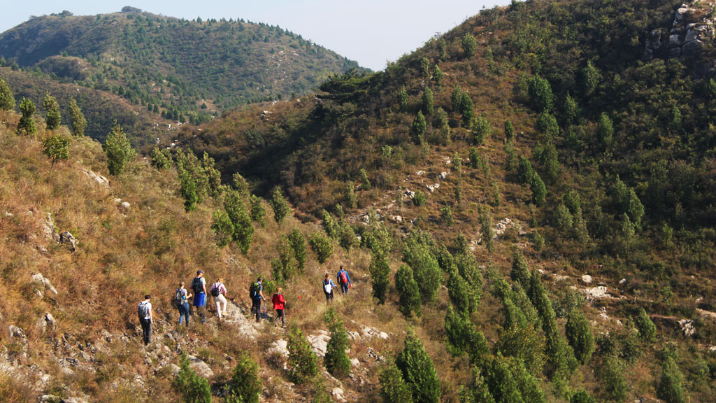
Qiulinpuzi is a small village deep in the mountains of Fangshan’s Shijiaying Township, tucked against the edge of Baicaopan — one of Beijing’s most famous autumn destinations, yet much quieter during the rest of the year. In September, the birch forest here grows on the shaded slopes above 1,500 meters forest is still fully green — dense, cool, and almost entirely to ourselves. The crowds haven’t arrived yet. Soft sunlight filters through the canopy, and the mountain feels quieter, calmer, and somehow more personal. It’s the mountain before it performs for anyone.


Hike Information:


l Date: Sep.12th (Saturday)


l Drive time: 2.5 hours each way


【The route type】Mountain village path + Forest trail + Alpine meadow


【The route description】The loop climbs from Qiulinpuzi Village through thick forest and up to the ridge of Baicaopan, reaching a high point of 1,873 metres before descending back through open meadows and tree cover. Most of the trail is in good condition and comfortable to hike. There is only one steep descent, where the slope is quite deep and challenging. Hiking boots are strongly recommended, and hiking poles will also be helpful for extra stability. This is a proper mountain day: sustained climbing, beautiful views from the ridge, and a descent that will make you appreciate the bus ride home.


Hike info:


l Distance: 11km


l Time to complete: 6-7hours


l Total ascent: 832m


l Total descent: 780m


l Peak: 1872m


l Lowest point: 1066m


Notice:


1. Take at least 3 bottles of water


2. Bring some lunch, and some snacks.


3. Wear hiking boots.


4. More details will be posted in the group one day early before hiking.


Itinerary:


Along this trail, we add 1–2 pickup stops for hikers if it works smoothly. Waiting times will be strictly enforced, and we will not wait for late arrivals. Drop-off will be at the same location as pickup when we return.


07.30h Liangmaqiao line10 exit B.


07:45h Departure from Dongzhimen line2 exit B (B1/B2).


(For this trail, we can stop at Gongzhufen 公主坟 ; If you need it, let us know.)


10.00h Arrive the point, beginning of hike.


17.00h Ending the hike.


19.30h Arrive in Beijing.


Activity Fee: 160RMB/person.


Price includes:


1. Transportation with a driver


2. Hiking Leaders: Lengzhi and Cathy Wu (intership)


3. One day outdoor insurance


4. Payment: transfer the fee by Wechat or Alipay when we confirm the event on Thursday.


Please note:


- Do not participate if you are sick or showing symptoms of fever or couching.


- Customer service: Mona (wechat id: mona_zhangli) If you have any suggestions orcomplaint, please feel free to leave messages.


- Photos will be used in the social media platform. If you don't want to show in the picture, let us know. Smile


Cancellation:


1. Kindly reminder: You can cancel anytime till the deadline on Friday 18:00PM. As we have to fix capacties for the bus and pay the driver and the guides. After deadline, we will have charge you 80% activity fee. Or you find another person not yet registered to join the hike. If your cancellation is on Saturday morning or if you are late and missed the hike, please pay 100% activity fee. We repect your choice. When you register for this activity, you accept this cancelation policy.


2. Bad weather plan:We will message you 1-2 days before the hike to let you know about theweather condition. If there is a thunderstorm, heavy rain or strongwinds it will be dangerous to do the hike in the high mountains. So we will cancel it or change the dates.


Join us:


Scan the QR in below to note the name of event. Then add you into the group.

Images

Awaiting moderation
Multiple dates 8:30 am - 16:00 pm Toggle calendar
Event QR Code
160/person

Yongshou Chan Temple sits in the hills directly above Zhoukoudian

— the UNESCO World Heritage site where the first complete Peking Man skull was excavated in , pushing our understanding of human habitation in this landscape back some , years.


The temple itself is much younger. Founded during the Ming Dynasty, it was expanded over successive dynasties and eventually designated a royal temple by imperial decree. A stone plaque bearing the inscription “Imperial Gift: Lingan Yongshou Temple” still survives today.


At the peak, the temple was home to to monks, while the annual Buddha’s Birthday festival attracted pilgrims who filled the entire compound. Then came . Japanese forces repeatedly burned the temple, followed by further destruction in the years that came after.


What stands today is the result of restoration carried out between and , supported by RMB million in government funding. In , the temple was officially listed as a Fangshan District cultural heritage site. And perhaps most remarkably, two catalpa trees in the courtyard survived it all. They were here long before the destruction, and they are still standing today.


Hike Information:


l Date: Sep.th (Sunday)


l Drive time: hours each way


【The route type】Temple approach path + Forest trail + Wooden boardwalk

【The route description】The loop starts from the temple gate and climbs through six named viewpoints, each with its own character. At .km, Yongshou Terrace looks back down over the entire temple. At .km, Tangyuan Terrace opens a view east toward the Zhoukoudian site — the valley where Peking Man lived, visible from a ridge that humans have been climbing for rather longer than the temple has stood. At .km, Yanhua Terrace enters the Cotinus forest on the main ridge — the smoke tree grove that turns deep red in autumn, still green now and completely to ourselves. At .km, Xiwang Terrace marks the highest point of the loop, with a clear-day view north toward the Beijing city skyline. At .km, Xingyun Terrace offers a shaded forest platform — cool, flat, and a good place to stop. The final section descends via Liangxian Terrace at .km along a shaded wooden boardwalk, easy underfoot and under a full canopy, returning to the temple gate at km.


Hike info:

l Distance: km

l Time to complete: hours

l Total ascent: m

l Total descent: m

l Peak: m

l Lowest point: m


Notice:


. Take at least - bottles of water


. Bring some lunch, and some snacks.


. Wear hiking boots.


. More details will be posted in the group one day early before hiking.


Itinerary:


.h Departure from Dongzhimen line exit B (B/B).

.h Arrive the point, beginning of hike.

.h Ending the hike.

.h Arrive back Beijing.


Activity Fee: RMB/person.

Price includes:

. Transportation with a driver

. Hiking Leaders: Simon or Lengzhi

. One day outdoor insurance

. Payment: transfer the fee by Wechat or Alipay when we confirm the event on Friday.


Please note:

- Do not participate if you are sick or showing symptoms of fever or couching.

- Customer service: Mona (wechat id: mona_zhangli) If you have any suggestions orcomplaint, please feel free to leave messages.

- Photos will be used in the social media platform. If you don't want to show in the picture, let us know. :)

Cancellation:


. Kindly reminder: You can cancel anytime till the deadline on Saturday :PM. As we have to fix capacties for the bus and pay the driver and the guides. After deadline, we will have charge you % activity fee. Or you find another person not yet registered to join the hike. If your cancellation is on Sunday morning or if you are late and missed the hike, please pay % activity fee. We repect your choice. When you register for this activity, you accept this cancelation policy.


. Bad weather plan:We will message you - days before the hike to let you know about theweather condition. If there is a thunderstorm, heavy rain or strongwinds it will be dangerous to do the hike in the high mountains. So we will cancel it or change the dates.


Join us:

Scan the QR in below to note the name of event. Then add you into the group.


Images

Oct 24 7:30 am -
Event QR Code
At which venue:
¥360 / ¥325 for members

An A-to-B hike in the Xiangshan and Xishan area that follows forest paths, fire-break roads, and park trails around and over hills and tops. Great for autumn colours!


The autumn colours in the parks in Beijing’s West Mountains are famous throughout China, and the area is correspondingly crowded when the colours are at their peak.


We usually avoid hiking here for that reason. But during the lockdowns in early 2020 the hills here were one of the few places to go for a hike, and we got to know all the little trails in between the most popular areas.


On this visit we’ll use those little trails and firebreak roads to skirt the crowds, traversing hill sides and hiking gullies filled with all the fiery colours of the fall season.


Cost: ¥360 / ¥325 for members


See a full description, more photos, and book online at https://www.beijinghikers.com/hike-in-beijing/view/1977/west-hills-red-leaves-route/


Beijing Hikers—fun and friendly hikes and trips around Beijing and greater China, since 2001.


For more updates on hikes and trips follow our WeChat account BeijingHikers北京爱山 and keep an eye on www.beijinghikers.com


https://www.beijinghikers.com / info@beijinghikers.com

Images

Oct 17 8:00 am -
Event QR Code
At which venue:
¥510 / ¥460 for members

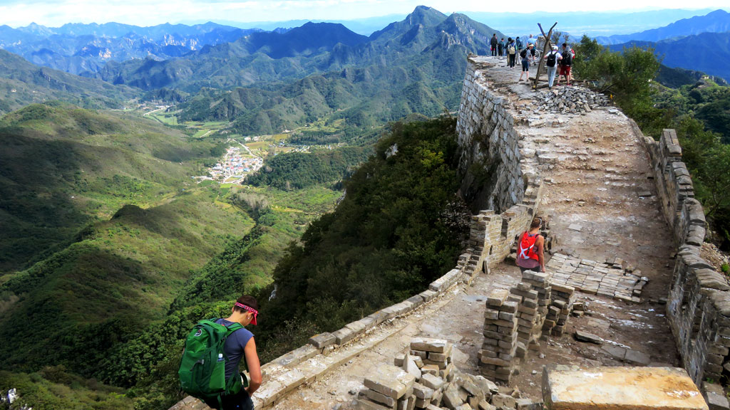
Walk from Gubeikou to Jinshanling, following stretches of restored and unrestored Great Wall and taking a detour through the pretty farmland that surrounds Hemp Village, finishing all the way over at the Jinshanling Great Wall.


The hike begins at the Gubeikou section of the Great Wall in Miyun County, very close to the border of the Beijing and Hebei provinces. Even though it’s designated as a park, this section of the Great Wall is largely unrestored. It’s not often visited either, probably because it is so far away from central Beijing.


We’ll start the walk with a short climb up to a tower on the Wall. There are a lot of towers on this stretch of the Wall – some in good condition, some tumbled down to foundations only. From the first tower we can see the Wall stretching off into the hills of northern Miyun. We’ll be following it the other way, towards Jinshanling, and Hebei Province.


It would be nice to walk on the Wall all the way to Jinshanling, but part of it borders military land and that section of it is blocked off. This means taking a detour through Spider Valley!


Once we’re out of Spider Valley we’ll start getting into the fields that surround Hemp Village. There are about 100 people living in this valley, surrounded by hills on all sides. They mostly grow corn in this area, but in the right season you can spot hemp and tobacco, and there are donkeys, cows, chickens, and dogs around as well.


Before we arrive at the main part of Hemp Village we’ll make a turn-off and head back up towards the Wall, following a trail up the valley. It will take about forty minutes to get up there, and parts of it get a bit steep. There are good views at the top – Gubeikou Wall one way, Jinshanling Wall the other – and we’ll stop for a snack and a bit of rest before heading down to Jinshanling.


We’ll be following the Jinshanling Great Wall from west to east, starting off on the unrestored section before heading down into the main restored area. We’ll follow the wall into the middle section of the Jinshanling Great Wall, and then up past both ‘Small’ and ‘Big’ Jinshan towers to reach Houchuankou Pass.


Cost: ¥510 / ¥460 for members


See a full description, more photos, and book online at https://www.beijinghikers.com/hike-in-beijing/view/2259/gubeikou-to-jinshanling-great-wall-5/


Beijing Hikers—fun and friendly hikes and trips around Beijing and greater China, since 2001.


For more updates on hikes and trips follow our WeChat account BeijingHikers北京爱山 and keep an eye on www.beijinghikers.com


https://www.beijinghikers.com / info@beijinghikers.com

Images

Oct 11 8:30 am -
Event QR Code
At which venue:
¥350 / ¥315 for members / ¥220 for kids

A long but not difficult ramble along country trails and lanes through pine forests, cornfields, orchards, villages, and farmland in Miyun District.


This trail originally took us five scouting trips to put together and changes a little bit every time we visit. The hike covers a wide range of countryside scenery, including country trails and lanes, pine forests, orchards, farmland, a reservoir, the Stonewall Village, and a chicken farm, and we may see some shepherds rambling about as well.


Cost: ¥350 / ¥315 for members / ¥220 for kids


See a full description, more photos, and book online at https://www.beijinghikers.com/hike-in-beijing/view/276/rolling-hills-and-empty-lanes/


Beijing Hikers—fun and friendly hikes and trips around Beijing and greater China, since 2001.


For more updates on hikes and trips follow our WeChat account BeijingHikers北京爱山 and keep an eye on www.beijinghikers.com


https://www.beijinghikers.com / info@beijinghikers.com

Images

Family Friendly Event
Oct 5 7:30 am -
Event QR Code
At which venue:
¥460 / ¥415 for members

The backwards version of our Chinese Knot hike—start by climbing up from Jiankou to ‘the Knot’, then down the back and over to the Great Wall Spur. Short but steep, with one tricky off-wall detour.


We’d usually do this hike the other way around because of some steep sections that are easier to go up than down, but the village on that end of the trail won’t let us up on the wall. (Coming down and out is fine, though.) It’s an excellent hike, so we’ll get on the trail by going backwards.


The hike involves a lot of climbing and scrambling, and you’ll need strong legs and a good head for heights to make it to the end.


In particular, if you're not comfortable with somewhat tricky terrain – broken wall and steep dirt tracks – we’d recommend you try a different hike.


Please contact us if you’re not sure about suitability. (We’d normally hike up this tricky section, but we’re doing the reverse version on this visit.) If it looked like the trail would be slippery, we’d likely cancel this hike and go somewhere else instead.


Cost: ¥460 / ¥415 for members


See a full description, more photos, and book online at https://www.beijinghikers.com/hike-in-beijing/view/1813/chinese-knot-to-xiangshuihu/


Beijing Hikers—fun and friendly hikes and trips around Beijing and greater China, since 2001.


For more updates on hikes and trips follow our WeChat account BeijingHikers北京爱山 and keep an eye on www.beijinghikers.com


https://www.beijinghikers.com / info@beijinghikers.com

Images

Oct 4 8:00 am -
Event QR Code
At which venue:
¥360 / ¥325 for members

A variation of our Vulture Rock Ridge Loop hike, finishing on the Beijing side of the hills instead of completing the loop. Great views and hill climbing exercise, finishing with a hike down of one of the main pilgrim’s trails in Beijing’s West Mountains.


This hike starts from a village close by to Miaofeng Temple, in Beijing’s West Mountains. We’ll follow part of an old pilgrims’ trail along a ridge with excellent views, up to a plateau, then up and along the Vulture Rock Ridge.


From the carpark in the middle of the village we’ll follow the main road up towards their orchards and terraces, turning off to head up a steep and twisting mountainside trail. Halfway up we’ll join one of the many pilgrim trails in the area, a roughly paved path that heads up to a saddle above the village.


A trail leads up the plateau and along Vulture Rock Ridge. At first it’s a broad gravelly trail along an old firebreak, which then meets a new road that was built up to the lookout point up top.


We’ll follow that road for a little while, and then get back on to hill trails to reach the highest point on the hike, at an altitude of 1,265m. The views are worth the climb – mountains all around, and views of the flat area that is slowly being filled by Beijing's urban sprawl.


From the peak we continue along the ridgeline, passing a marker on the intersection of three of Beijing’s districts.


Coming down a steep dirt trail we arrive at a fork in the trail– to the right, the trail down the Beijing side of the hills; to the left, the trail that would take us back to the village where we started.


Today we’re heading over to the Beijing side, following a great trail along the side of a larger peak, passing by crags and under rocky outcrops as we walk though deciduous forest.


Cost: ¥360 / ¥325 for members


See a full description, more photos, and book online at https://www.beijinghikers.com/hike-in-beijing/view/657/vulture-rock-ridge-and-the-old-pilgrims-trail/


Beijing Hikers—fun and friendly hikes and trips around Beijing and greater China, since 2001.


For more updates on hikes and trips follow our WeChat account BeijingHikers北京爱山 and keep an eye on www.beijinghikers.com


https://www.beijinghikers.com / info@beijinghikers.com

Images

Awaiting moderation
Sep 27 8:00 am -
Event QR Code
At which venue:
¥450 / ¥405 for members / ¥220 for kids

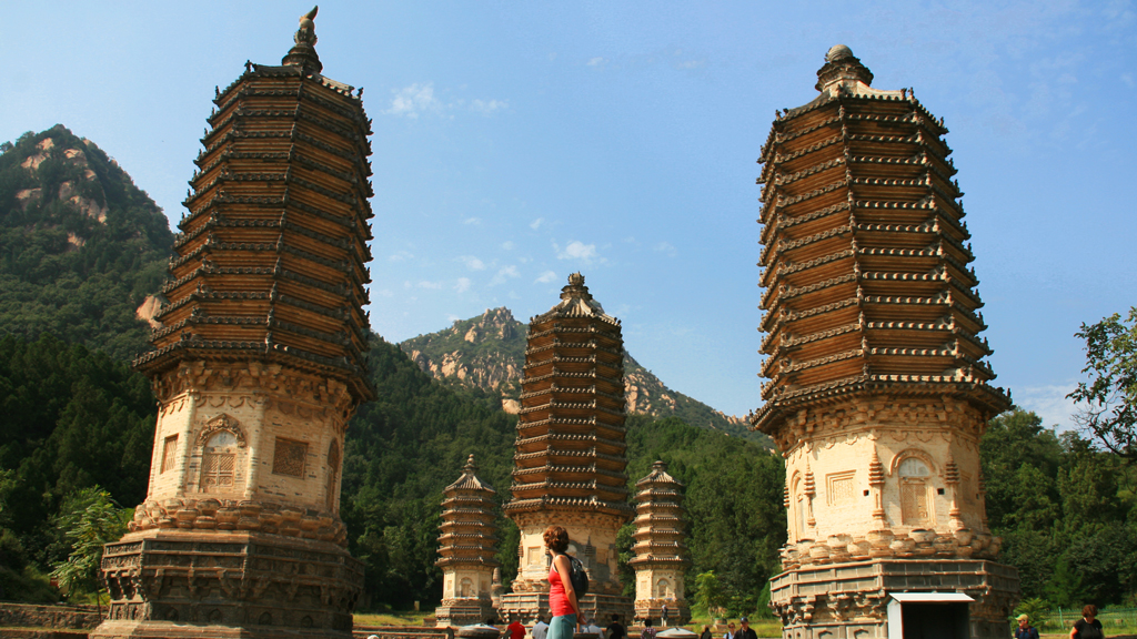
Follow a trail through the Changping countryside, passing villages, quarries, and a local shrine on the way to the Silver Pagodas, a set of five well-preserved 600-year-old pagodas that are all that remains of a big Buddhist temple. Includes a post-hike lunch at a countryside restaurant.


We start off with a walk through a small village, stopping for a quick look at a 300-year-old performance stage and a temple. The houses in the village are mostly built from granite – likely sourced from a nearby quarry. After walking through the village we'll follow a slowly ascending path through the countryside, passing an isolated shrine, fields, and concrete water reservoirs as we circle Silver Mountain.


The path takes us into a small village on the other side of the ridge, and we'll follow dirt streets through its outskirts, walking past donkeys and old stone houses on the way to the chestnut orchards behind the village.


Around the hill behind the village we'll find what's called the "Valley of Mercy", and this is where the path starts to get a lot steeper, heading past more quarries and following a hillside trail up to the top of Holly Mountain. The valley is not too merciful to the legs. It's quite a good climb!


Towards the top we'll find the Silver Pagoda park trail, and climb its steps to the viewing platform at the top. We can look down on the pagodas from there, and will have an unobstructed 360° view of the surrounding mountain peaks and countryside.


From the top we'll follow the park trail down to the pagodas, passing the Bell Pavilion, the Waist-Turning Pagoda, the Preaching Platform, and other spots used by the monks and nuns when the temple was still active.


Cost: ¥450 / ¥405 for members / ¥220 for kids


See a full description, more photos, and book online at https://www.beijinghikers.com/hike-in-beijing/view/389/silver-pagoda-loop-2/


Beijing Hikers—fun and friendly hikes and trips around Beijing and greater China, since 2001.


For more updates on hikes and trips follow our WeChat account BeijingHikers北京爱山 and keep an eye on www.beijinghikers.com


https://www.beijinghikers.com / info@beijinghikers.com

Images

Family Friendly Event
Awaiting moderation
Sep 19 20:00 pm -
Event QR Code
At which venue:
¥400 / ¥360 for members

Moderately difficult hill walking in the mountains north of the Ming Tombs.


The first part of the hike is on mostly flat ground, first on the road that leads through Longevity Village, and then on a dirt trail that heads up into the hills, passing through all the terraced chestnut fields that are a major source of income for the villagers.


As we get closer to the point where we cross over the ridge, the trail starts to zig-zag as it climbs up the hillside, eventually rising to the saddle between two peaks—a good place for a rest!


From the saddle, we follow a largely disused trail down into the valley on the other side.


A sealed road leads down into the village where we begin a hike called Tomb Raiders, and, after a sharp turn at the village square and exercise machine yard, we’re back into the hills, following another valley trail up on to a ridge.


It’s a slightly tougher climb this time, getting rather steep near the top. There are quite a few false peaks on the way up, but these provide a good opportunity for a rest! If you don’t think it’s tough enough, there’s an option to take a short detour to the highest hill in the area, where there’s a rusted trig and great 360° views of the area, including many of the Ming Tombs.


From there, it’s down all the way, following a gravel trail that was blazed when power lines were put in. The path winds through scraggly pines, and takes us past a small dam on the way out to the finish point for the hike – a stele just outside one of the Ming Tombs that unfortunately isn’t open to the general public.


After we’ve finished the walk around the tombs and had our Beijing Hikers picnic, we’ll take a short drive to the Sacred Way.


The Sacred Way was the official entrance to the tombs during the Ming Dynasty, and features a long path between large gates with inscribed tablets and stelae, flanked by statues of animals and officials. The bus will drop us off at the entrance, and meet us around twenty minutes later at the other end before driving us back to Beijing.


Cost: ¥400 / ¥360 for members


See a full description, more photos, and book online at https://www.beijinghikers.com/hike-in-beijing/view/345/longevity-village-to-the-ming-tombs/


Beijing Hikers—fun and friendly hikes and trips around Beijing and greater China, since 2001.


For more updates on hikes and trips follow our WeChat account BeijingHikers北京爱山 and keep an eye on www.beijinghikers.com


https://www.beijinghikers.com / info@beijinghikers.com

Images

Awaiting moderation
Sep 13 7:30 am -
Event QR Code
At which venue:

A moderately-difficult loop hike in Beijing’s northeast that follows old roads and tracks through the mountains to pass by Big Tiger Stone and through Yellowstone Gap, with a good climb near the end to check out a short stretch of repaired Great Wall.


After a short walk from the village square, we’ll be on to a rough gravel road that leads up into the mountains. The road was built in order to access some fields farther up the valley.


The land farther up the valley is rather marginal in terms of farming – there’s not a lot of flat ground in between the steep sides of the valley. The fields are mostly fallow now. We’ll spot a few little shacks and farmhouses on the way up, and in the right season we’ll be able to pick some wild hawthorns.


On the way up we’ll also pass one of the main landmarks on the hike, where the sides of the valley turn into cliffs and leave a narrow winding gap to walk through.


As we get further into the valley the hills turn into crags and we’ll be in for the main ascent of the hike, working our way up a hillside to cross over at a pass in the mountains.


Cost: ¥400 / ¥360 for members


See a full description, more photos, and book online at https://www.beijinghikers.com/hike-in-beijing/view/1715/yellowstone-gap-2/


Beijing Hikers—fun and friendly hikes and trips around Beijing and greater China, since 2001.


For more updates on hikes and trips follow our WeChat account BeijingHikers北京爱山 and keep an eye on www.beijinghikers.com


https://www.beijinghikers.com / info@beijinghikers.com

Images